


This trip is called the Laurel Lake Loop in a book or two, but I’m calling it the Vernon Lake Loop. (We liked Vernon a lot more than Laurel!) It was about 30 miles, somewhat early season (June 17 thru June 23 – 2006), sported plenty of rushing water and gushing waterfalls, some mosquitoes but not too bad, and though it’s not a very high elevation trip, the Vernon Lake area especially delivers some beautiful, high elevation granite for its modest 6500 feet.
Lots of butterflies and flowers, surprisingly humorous salamanders (California Newts), brisk water that is likely much more swimmable in July and August, some dicey water crossings, rattle snakes, poison oak, and just a whole lot of fun…
I wasn’t sure what I’d feel seeing the Hetch Hetchy Reservoir, being that it’s another case of humans partly ruining an entirely beautiful part of the planet. Sadly the decision to damn it for a water supply for the Bay Area was made as the final strike against the final battle for Mother Nature that John Muir waged.
The trip was mostly out of view of the reservoir, but I will say that as messed with as it is (basically turned into a fake lake), the natural rock formations and mountains that are visible are beautiful indeed. Meaning this in no way as sexist or anything, I likened seeing the beauty of what is there at Hetch Hetchy to seeing a wonderfully shaped and attractive woman, but seeing her just from the waste up. Uh, I mean that like, you know, as a painter or sculptor would be seeing such a woman, not like a Beavis or Butthead type comment. Oh, never mind!
Anyhow, this was another awesome backpacking trip, and I went with Julie Kanani O’Rielly, who has been my backpacking partner for a number of years now. (You get to be my age and it’s amazing how few backpacking friends still want to go on these trips anymore.) Julie puts as much into the planning of these trips nowadays as I do, in fact, probably more.
There are two paths to the photos. Thumbnails are the pages of little pictures and you can click on any of them to jump into the Slideshow. Everything links to everywhere as need be, and hopefully it’s fairly obvious. The Slideshow has my running brief commentary, and yes, for this trip there are even a few movies. “Play Movie” will assume you have the Flash plug-in. The file has to download, but each little movie is a pretty short clip…
Most the pictures are mine, and the ones that Julie took have a “photo by Kanani” underneath my comment. Her camera is a Nikon Coolpix 5200, and mine now is a Canon S3 IS…
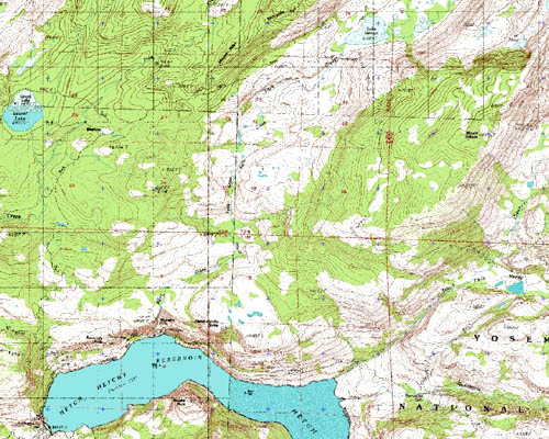
As for the map on this page (below this paragraph), it’s of course pretty useless at this low resolution for the web. The trip went from the left end of the big blob of blue (Hetch Hetchy), up to the blob of blue on the extreme left and a bit down from the top (Laurel Lake), then over to the top towards the right, about a third of the way from the map’s right edge where there’s another blob of blue (Vernon Lake), then down to about one third up on the right where there’s another blob that’s kind of a triangle (actually the very wet meadows by Tiltill Valley which we carefully sumped through in our ‘water mocs’ on our way from Tiltill to Rancheria Falls (pretty close to the bottom of the picture, a smidgeon to the right of the big blue blob that is Hetch Hetchy), and then along the top of the big blue Hetch Hetchy blob back to the start of the trip. I think the damn dam is called the O’Shaughnessy Dam, probably named after the guy who told the workers how to build it.
As for my little comment about not liking Laurel Lake, I should say that it is more wonderful and beautiful than the prettiest building, dam, or freeway overpass, but while I always enjoy the beauty and realness in all the wild places I visit, some places are of course more appealing than others. Laurel Lake’s problem was that it had almost no access from anywhere around the lake, save for the outlet area, and a couple camps of people were already there. And the mosquitoes were worse there than anywhere else on the trip. The place could have used a good breeze! But it was just our first night in, and since crossing Frog Creek to get to it was such an experience (almost a waist high ford with some super strong rushing current), it was certainly all good in the long run.
Hope you enjoy the pictures!
Page Created: August 26, 2006
Updated: August 26, 2006